
3. Maps: “Air and Rail Transport in Germany“
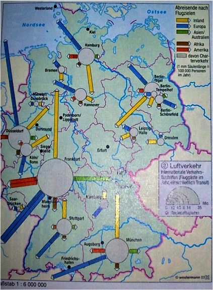
C1. Map: “Air Transport in Germany”
 Click image to enlarge
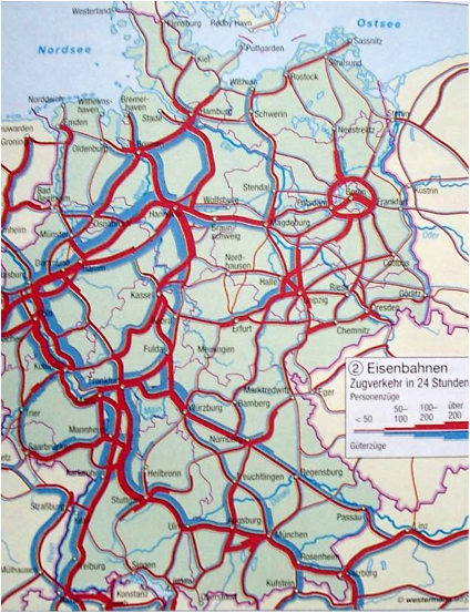
C2. Map: “Railway Transport in Germany”
 Click image to enlarge
Questions
Geographical/Historical Context
Today, increased mobility and constantly growing population worldwide contribute to the increasing demand for connections from A to B which are as fast as possible. This can only be realized by creating a sound infrastructure. While trains and ships were mainly used in human and freight transport in the 19th century, a wider variety of means of transport are available today.
Without this combination of plane, lorry, train and ship transport, international cooperation would not work anymore. Geographical obstacles are overcome in a fast way by means of the latest technology; thus, for example, rivers can be dredged and widened, mountains (e.g. Alps) and seas (cf. Channel Tunnel) can be made open to traffic, yet often at the expense of the ecosystem.
Answer to the Questions
1:
- Railway network developed more densely than airport network; thus, the whole Germany is connected to the railway system (mobility).
- On C1 and C2, congested areas are situated close the the main cities.
2: Train, ship, motorway, bus, bicycle.


Presentation
Due to the increasing international integration, a growing popularity of air transport can be observed.
Without combining various means of transport, a proper functioning of economy or society would not be possible anymore nowadays.